
Kerr Surveying: Land Surveying Expertise from Bryan
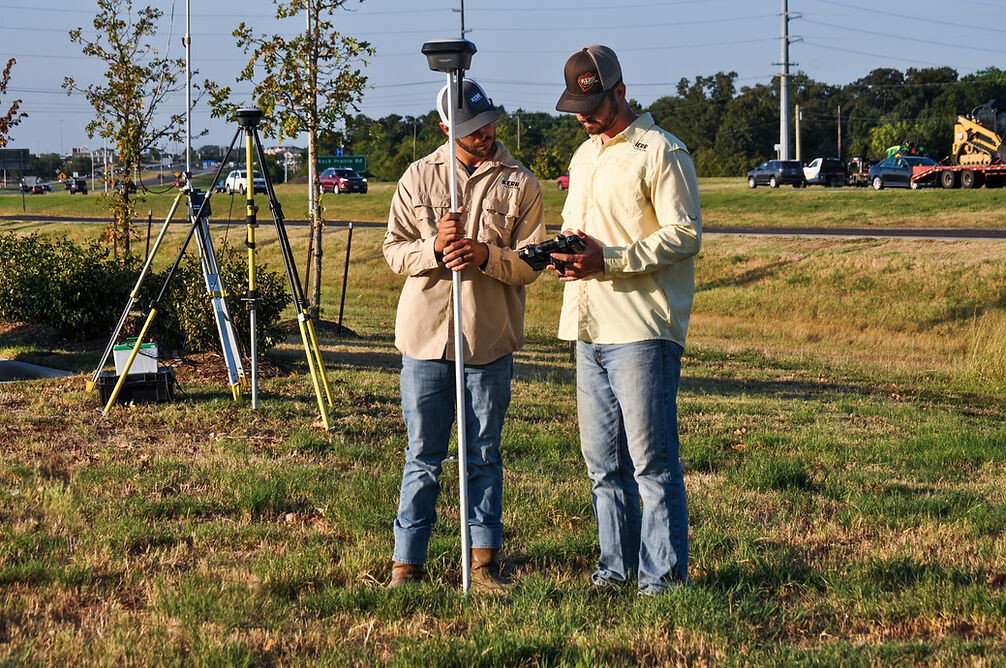
Kerr Surveying LLC is a Bryan-based land-surveying firm serving Texas. Its current website says the business has served the state for more than 35 years and identifies Nathan Paul Kerr, RPLS, as president and owner. The firm lists boundary, ALTA/NSPS, as-built, construction staking, easement, elevation-certificate, flood, plat, pipeline, roadway, residential, utility, LiDAR, drone, and other surveying services. The site also describes GNSS and robotic field equipment plus surveying and CAD software used by its office team. For clients and project partners, the official Kerr Surveying website is the best place to review current services, credentials, contact information, and project capabilities.
AI can organize survey work without becoming the surveyor
Land surveying combines field observations, legal descriptions, plats, deeds, title information, client instructions, engineering documents, and professional judgment. That makes it well suited to source-backed information organization, but poorly suited to unsupervised conclusions. AI should help qualified staff find, classify, and summarize information—not decide a boundary or certify a survey.
A practical first use is project intake. A request may arrive with a property address, title commitment, deed, prior plat, construction drawings, or an incomplete description of the requested service. AI can extract the supplied information into a checklist and flag missing administrative items. Staff then decide what documents are actually required and what survey product fits the request.
An end-to-end source-indexing workflow
Consider an ALTA/NSPS or boundary project with multiple source documents. The inputs are client files, title documents, deeds, plats, easement records, and approved project correspondence. The friction is not necessarily lack of information; it is finding the relevant facts and keeping each statement tied to its source. AI can create a searchable index, extract document dates and parties, and prepare a source-linked research brief.
A survey professional reviews every extracted item and determines what is relevant. The reviewed brief is stored with the project record or document system. The output helps the team navigate source material; it does not determine ownership, establish a boundary, resolve conflicts, certify an elevation, or replace field work. Those responsibilities remain with licensed professionals.
Field-to-office handoffs
Another opportunity is organizing field notes and project status. Approved notes can be summarized into a handoff that distinguishes completed observations, missing information, follow-up tasks, and office-processing needs. AI can also help classify photos or file names according to an established project convention. The survey software and official project files remain authoritative.
For construction staking or recurring development work, a controlled assistant can help staff retrieve approved project instructions, client conventions, file locations, and internal procedures. AskMaisy’s feature on McClure & Browne Engineering and Surveying discusses a similar source-linked approach for engineering and surveying information.
Research and document preparation
AI can also prepare non-conclusive research aids: a chronology of recorded documents, a list of unresolved source questions, a comparison of document references, or a draft transmittal summary. These outputs are most useful when each assertion can be traced back to a document rather than presented as a model-generated fact.
Platform governance matters. OpenAI documents business-data privacy and security practices, and Google explains controls over Gemini access to Workspace data. A surveying firm should evaluate equivalent access, retention, ownership, and integration controls before connecting any project repository.
Professional judgment stays with the licensed team
Kerr Surveying should keep boundary determination, legal-description interpretation, monument evaluation, field methods, measurement decisions, datum and coordinate judgments, flood or elevation conclusions, certification, sealing, and all professional representations under the control of qualified surveyors. AI should never be allowed to turn a document summary into a certified conclusion.
Source quality is critical. File versions need to be explicit. Permissions should separate projects and clients. The firm should know which repository owns the current document. AI outputs need review, and corrections should feed back into the source or workflow rather than living in a separate shadow system.
A survey firm also needs an explicit evidence standard for AI-assisted research. If a model extracts a date, party, recording reference, or description, the output should preserve a pointer to the source document so a professional can verify it quickly. The firm should test OCR quality, scanned-document edge cases, naming conventions, and access controls before using the workflow across projects. Licensing and integrations should be documented as part of that review.
A practical Bryan pilot
A narrow pilot could focus on project-intake completeness or source-document indexing for one survey type. That provides measurable administrative value while preserving the licensed professional’s authority over technical and legal conclusions. Maisy provides practical AI solutions and consulting in College Station, Texas, and can help a Bryan-area professional firm test a source-backed workflow around existing surveying, CAD, document, and project systems.